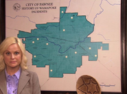
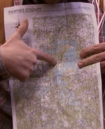
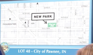
The following are various maps of the city of Pawnee, Indiana.
Some long-distance maps and one aerial photograph seem to be based on Muncie, Indiana, flipped upside down and/or around.[1][2][3][4]
More detailed maps are taken from Christchurch, New Zealand.[5][6][7] The rivers, roads, and most importantly parks on the Pawnee Parks Map and other street maps match almost exactly with Christchurch between Hagley (Ramsett) Park and Madras (Collins) St, though there are more parks in Christchurch.[8][9] Most street names have been changed, but some remain (e.g. Bealey Ave, Kilmore St, Durham St North, Chester St West, Bedford Row, Harper Ave, Carlton Mill Road) and others have been changed slightly (e.g. Colombo/Columbus St, Victoria/Victory St, Moorhouse/Michigan Ave, Worcester/Waverly Blvd, Selwyn/Selma St). The hospital is in the same place, and the elite private boys' high school Christ's College has been replaced with Pawnee Community College.
Citations
- ↑ http://patch.com/florida/sarasota/parks-and-recreation-s-aubrey-plaza-is-muncie-real
- ↑ http://www.ballstatedaily.com/article/2015/01/parks-and-recreation
- ↑ http://www.indianapolismonthly.com/arts-culture/11-notable-nods-indiana-parks-and-rec/
- ↑ https://lizboltzranfeld.files.wordpress.com/2012/04/muncie-pawnee-21.jpg
- ↑ https://rebuildingchristchurch.wordpress.com/tag/parks-and-recreation/
- ↑ http://www.stuff.co.nz/entertainment/tv-radio/9555486/Finding-your-way-easier-in-Pawnee
- ↑ http://www.moatatamaira.co.nz/2015/01/26/christchurch-is-pawnee-again/
- ↑ https://www.openstreetmap.org/#map=15/-43.5304/172.6341
- ↑ https://www.google.co.nz/maps/@-43.5304518,172.6333341,16z


